11th June 2023
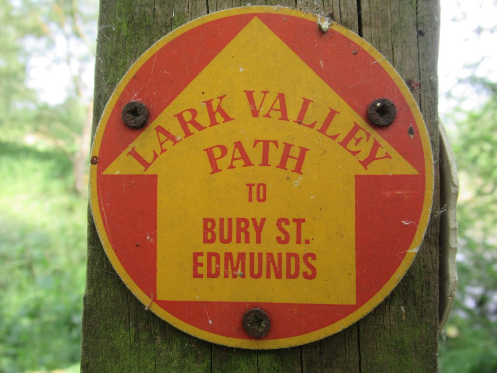
MILDENHALL TO BURY ST EDMUNDS
This is another short riverside walk in Suffolk, this time in the west of the county. It mostly follows the River Lark between the towns of Mildenhall and Bury St Edmunds. I was born and raised in nearby Newmarket, so I’m familiar with some short stretches of the route.
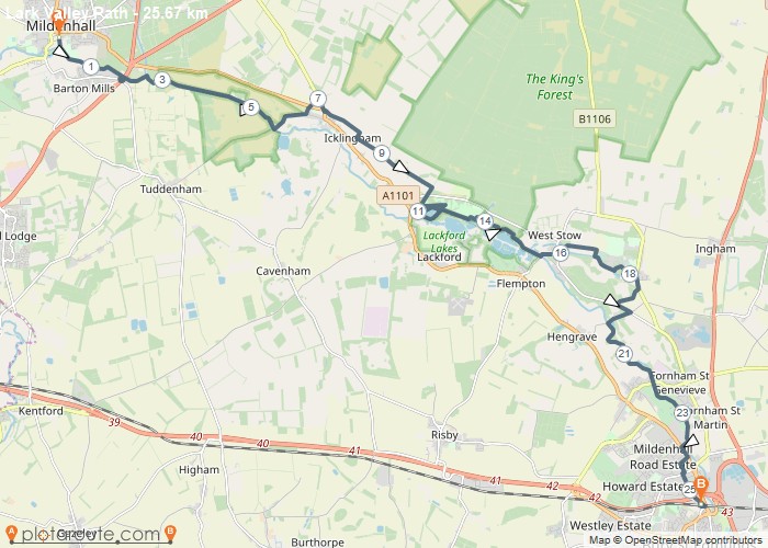
It’s the first hot weekend of the summer in this part of the UK and I arrive in Mildenhall in bright sunshine. I don’t know why the trail starts here as this is the middle section of the River Lark – the river flows north-west from here into the Cambridgeshire Fens and joins the River Great Ouse just north of Ely. According to the map, that stretch appears to be fully walkable and you could easily turn this into a two day walk. As it is, I walk the other way, south-east, against the flow of the river.
The start of the walk is a short distance from the bus station, at a park called Jubilee Fields where the river has the appearance of a village duck pond, with various swans, geese and ducks, and many fishes swimming about. It is at its widest here and will get narrower towards Bury St Edmunds. In the past it was navigable all the way to Bury, but nowadays is too silted and overgrown with vegetation.
A good paved section follows the northern bank of the river through a wooded area with some large gardens on the other side, and I soon arrive at Barton Mills – named after the water mills that used to stand along the river here. I stop off at the Bull Inn, a pub built in the 16th century that is said to have hosted both Queen Elizabeth I and Queen Victoria. I hope they got better service than I do, as the woman who serves me can’t even be bothered to say hello and she short-changes me by a pound, on a beer that already costs nearly £6. When I point it out, I am stared at suspiciously for a good ten seconds before the money is grudgingly handed over with no apology. Maybe they don’t like strangers round these parts.
The pub sits beside the busy A11 dual carriageway and it isn’t immediately obvious how to cross it. Eventually I find a cycle path that crosses each carriageway separately and I continue along the river. The path from here is a narrow strip of mown turf between tall nettles, many of which are leaning across the way. Fortunately it seems to be well maintained, but this short section could quickly become overgrown and impassable if not mown regularly.

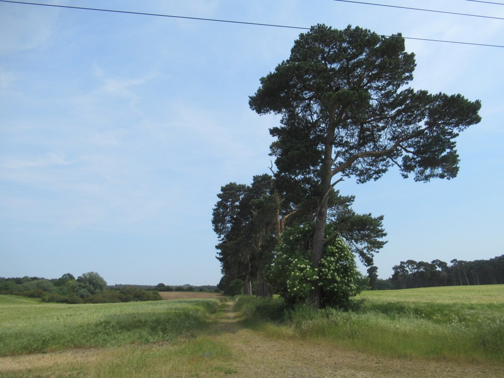
I pass over the Cut Off Channel, a man-made drainage channel that flows north from here for 28 miles (45 km) to Denver Sluice in Norfolk, and then I pass through the most pleasant part of the walk, with nature reserves on either side of me. To my left is Icklingham Plains and across the river to my right are Tuddenham and Cavenham Heaths. This is the southern part of the Brecklands, the large sandy area of forests and lowland heaths that straddles the border between Norfolk and Suffolk. I have vague memories of being brought here as a kid, on a nature club outing, and shown rare Stone Curlews. Today I see Cuckoos, a Marsh Harrier, and a secretive Water Rail in a wooded ditch – often heard but rarely seen.
Further along, a few people are swimming in the river. I don’t blame them as it is getting really quite hot and humid now.
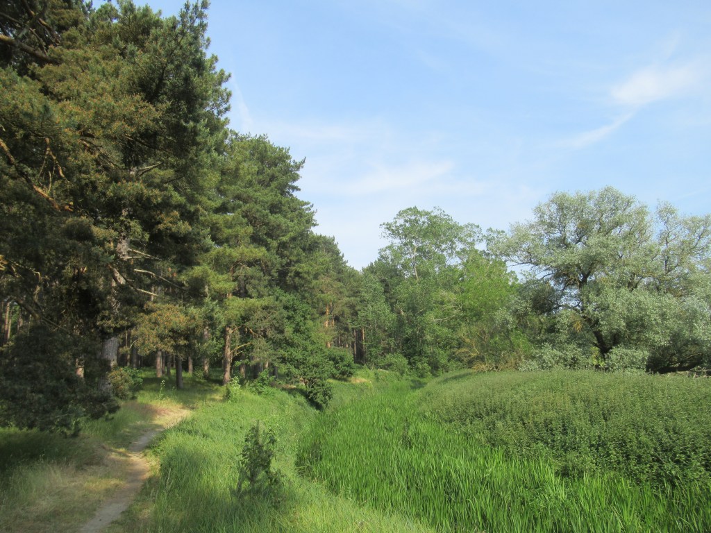
At Temple Bridge the path curves away from the river and joins the Icknield Way – one of Britain’s oldest pathways, said to pre-date the Roman occupation. This takes me around the northern edge of Icklingham village and then across some sandy, slightly hilly farmland growing mostly barley and potatoes. Eventually the Icknield Way Path turns to the north and my path turns south towards West Stow Country Park, where I re-join the river and disturb a large Grass Snake that shoots off into the undergrowth.
The waymarks into, and through, the country park are a bit confusing and I go wrong somewhere along the way, walking around the wrong side of a lake. I’ve been here a few times before and it’s very pleasant, so I don’t mind a bit of a walk around to regain the trail. There is a reconstructed Anglo Saxon village here which I visited many years ago.
I follow the river out of the park and through some tightly packed conifers. Across the river is Lackford Lakes Nature Reserve, another place I used to visit when I lived more locally, and eventually I reach sleepy West Stow village. There are very few Lark Valley Path waymarks here but since leaving the Icknield Way I have been following St Edmund’s Way, which is much better signposted.
The path now leaves the river again and passes through the grounds of Culford Hall, an impressive building that houses a private school. Three Red Kites are circling over the parkland. I walk alongside a lake with a grade one listed bridge, then leave the grounds via a driveway lined on both sides with magnificent Redwood trees.


A short walk from Culford village I join the river again and continue on a very good path to a bridge. After a long rest I cross the river for the first time and the trail now follows the southern bank. It has gone 6pm and the weather is now much cooler and more pleasant. After crossing the B1106, the path follows the curve of the river along the edge of a golf course. The river is little more than a stagnant ditch by the time the path turns away from the waterside and arrives on the edge of Bury St Edmunds, where another Red Kite flies overhead. This is still some way from the source of the River Lark, but it has no footpath from here on.
After a brief walk through suburbs and along a cycle path, I cross a footbridge over the noisy A14, and then complete the walk at the railway station. As the station is situated in the northern side of the city, the path doesn’t visit Bury’s historic centre, but I’ve already been here many times before.
16 miles 25km 8 hours
This was another easy and pleasant day-walk through some picturesque scenery and historical landmarks. It is 13 miles (21km), but I somehow walked a bit more. I would maybe walk it again in the opposite direction, and then continue on beyond Mildenhall for a second day of hiking to the River Great Ouse.
The trail was mostly flat and well maintained and, despite the lack of Lark Valley Path waymarks along some stretches (and at least a couple pointing the wrong way) it was easy enough to follow using an OS map, either by following the river or by using Icknield and St Edmund’s waymarks. Most of the route is covered by OS 155 Landranger map, with a very small section at Mildenhall covered by OS 143. Another short section at Barton Mills goes onto OS 154, but this isn’t really needed as long as you follow the river.
Refreshments are available at the pubs in Barton Mills and slightly off the trail in Icklingham, as well as cafés at West Stow Country Park and the golf course near Bury St Edmunds. Mildenhall can be reached by bus and Bury by bus and train. Buses run between the two towns, so you can park at one end of the walk and get a bus back.

Leave a comment