Tuesday 5th September 2023
EAST WITTERING TO BOSHAM
Today will be another long day, even longer than yesterday in fact. The route meanders up and down the channels of a large estuary, rather than straight along the coast, so it’s difficult to estimate its length by glancing at the map. Fortunately I don’t get around to measuring the distance until after I’ve completed it, so I’m blissfully unaware of how far I’m walking until it’s over. The fact that I’m not carrying my pack today, and the frequent pubs spaced conveniently along the route, make the task much easier.
After a breakfast of coffee and pastries on East Wittering seafront I head off along the coast, making quick progress on the firm sand where the tide has gone out and then on a good path at the top of the beach. I pass by a memorial to the allied troops of WWII who took part in the D-Day landings, many of whom trained in this area.

Soon I reach the mouth of Chichester Harbour. This is a large natural harbour that splits into numerous channels and peninsulas. It will take me at least three days to walk around it before I get back to the coast. Before I start I walk a quick loop around East Head, a club-shaped spit of sand dunes managed as a nature reserve by the National Trust. It’s very busy with dog walkers today, blowing their annoying whistles and shouting at their pets in that weird, high-pitched voice they do. The coast guard are also in evidence, with vehicles driving up and down the beach and a helicopter flying back and forth at low altitude. It appears to be a training exercise rather than an actual incident.

Once I set off around Chichester Harbour it immediately becomes much more tranquil. The shouty raucousness of the coastal resorts is left far behind and I proceed along good footpaths, occasionally wooded, with arable land on my right and bird-filled salt-marshes on my left. This whole area has been designated an Area of Outstanding Natural Beauty and a Site of Special Scientific Interest, as well as several other protective designations.
One of the numerous shorebirds I see has been fitted with coloured leg rings as part of a migration study. I jot down the colour combination and when I get back home I’ll file the details on a website that will send them to the appropriate research project. A few days later they will email me with the bird’s life history based on other reported sightings around the world. These studies rely on people sending in their sightings, so it’s nice to do my bit and contribute a single data point to science.
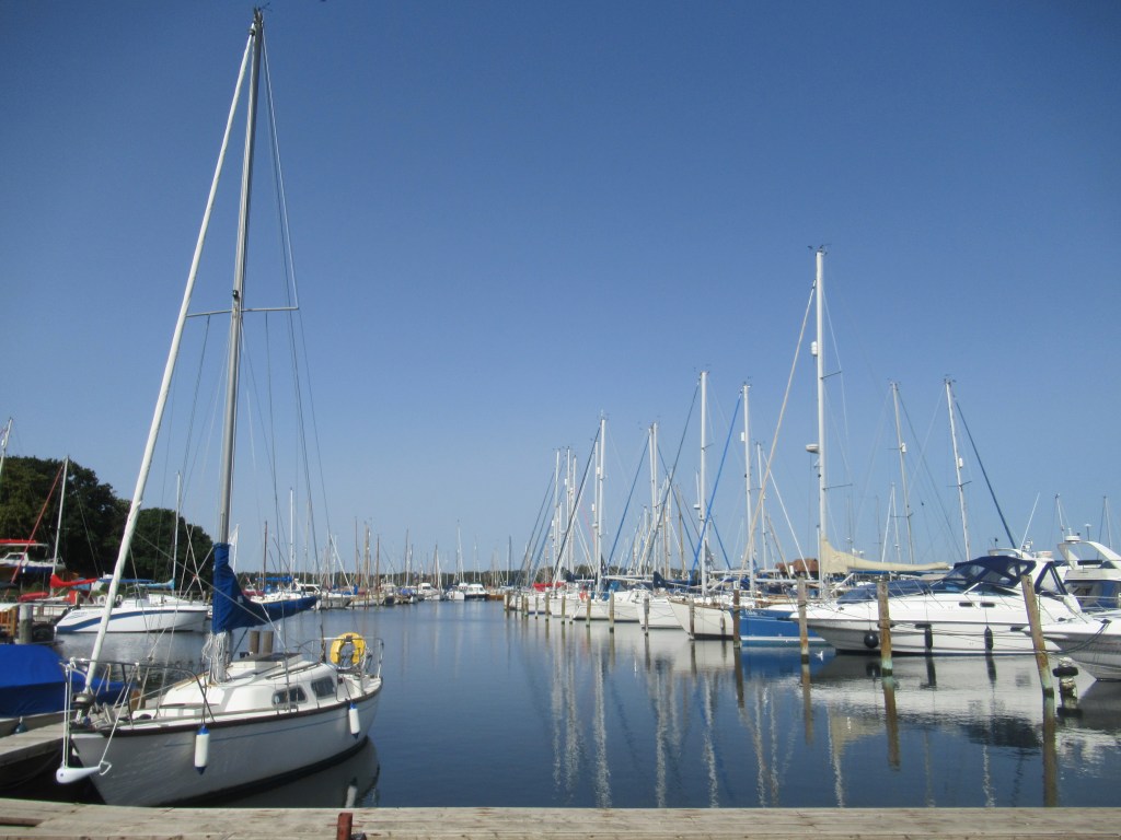
Chichester Harbour is dotted with picturesque villages and the first one I visit is West Itchenor, where I stop at a café and have a sausage ciabatta for second breakfast. The busy waterfront area is filled with sailing boats and yachts. Sailing is very popular around here, with more than 12,000 craft using the harbour and numerous sailing clubs along its shores. Judging by the houses, cars and accents I come across, this whole area is very prosperous.
Further on I see a large swarm of Hirundines hawking for insects over a bean field, then find a huge pre-migration flock perched on wires – mostly Swallows with a few House Martins and Sand Martins amongst them. I count at least 400, which is the biggest gathering I’ve seen for as long as I can remember.
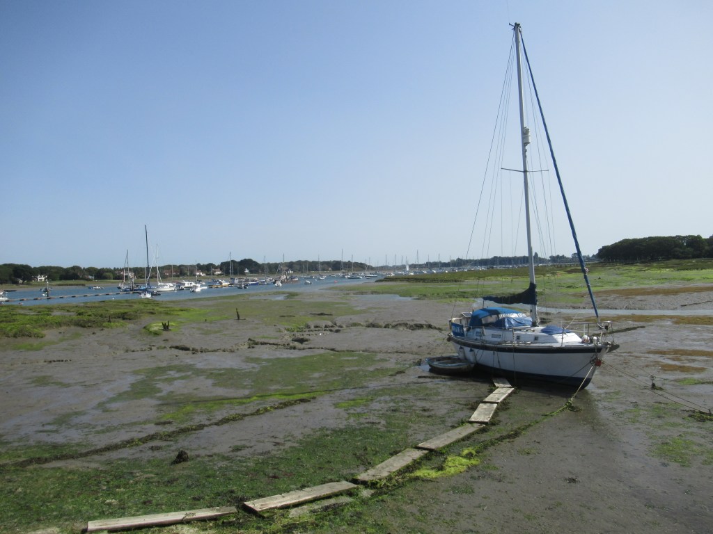
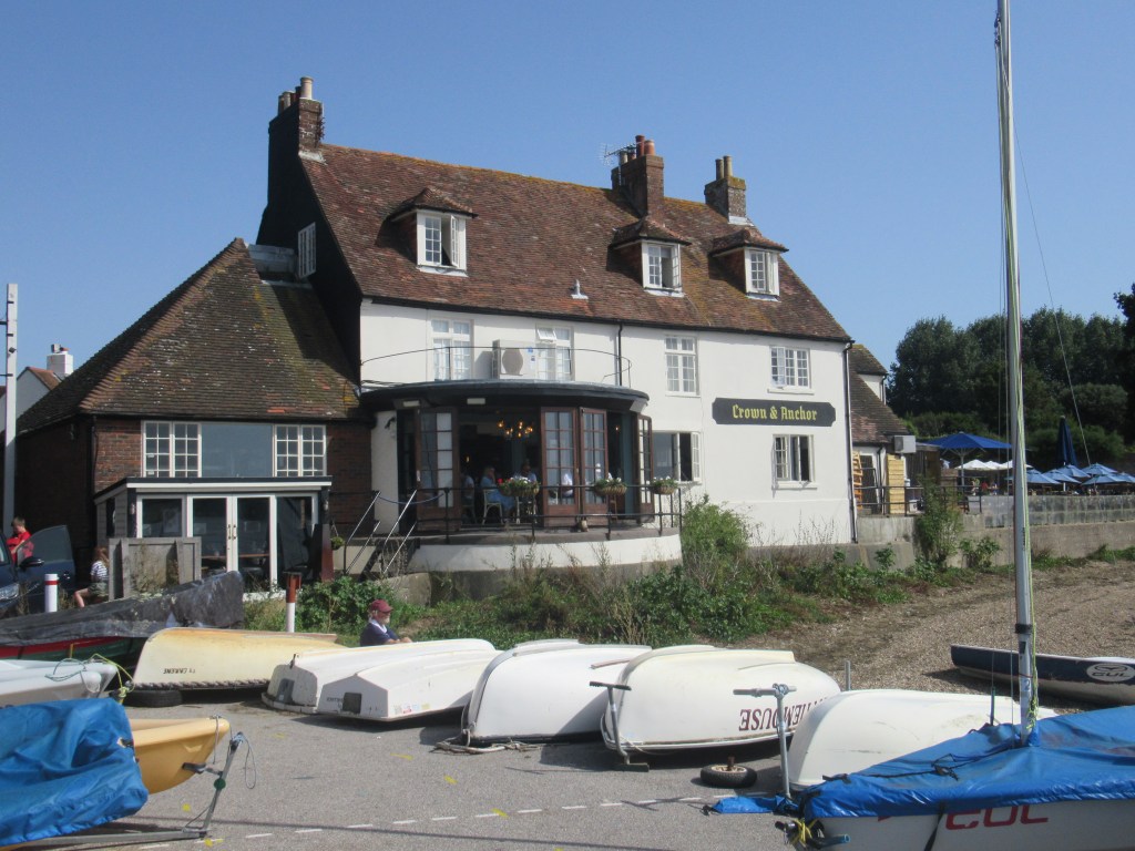
Soon I cross one end of the Chichester Ship Canal, opened in 1822, where some impressive houseboats are moored. Next to this is a large yacht marina and then the path continues through a small wood and along the shore to the tiny village of Dell Quay, from where I get my first views of Chichester Cathedral spire up ahead. I stop for a drink in the pub here and find a rare bit of shade in their beer garden. It’s lunch time now and quite a few people are out enjoying the sunshine.
From here it’s a short walk to Fishbourne at the head of the creek. I could catch a train to Chichester here and end the day’s walk, but I decide to continue around the next peninsula. I want to put the effort in now and make the final day shorter when I’ll be carrying my backpack again, so I have another break in another pub before continuing.
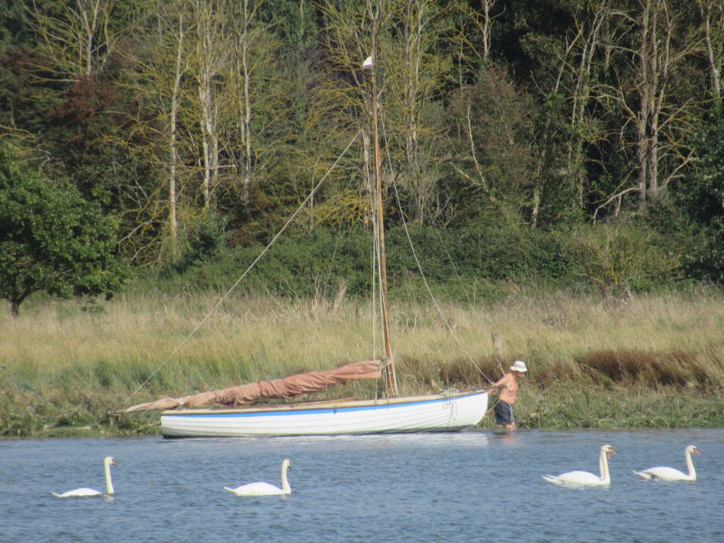
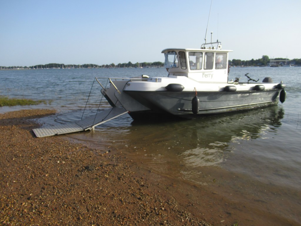
The trail starts off well with a walk along the shore of Bosham Peninsula, but I soon come to some private land and have to turn inland for a couple of miles of boring road walking. When I reach the shore again on the other side of the peninsula I’m just across the water from West Itchenor where I had been this morning. The footpath from here is impassable at high tide and, not wanting to walk inland again, I wait for it to subside a bit more. There is a small foot ferry from here across to West Itchenor and I decide to go across and back just for the hell of it and to kill a bit more time. I sit and admire the early evening view over the harbour before making the return crossing, and we detour along the way to drop a couple of guys off on their yacht.
Once back on the Bosham Peninsula I am able to walk the coast path, now slightly wet and muddy from the receding tide, until the picturesque village of Bosham comes into view on the other side of a narrow bay. Walking around the bay, I find that the road into the village also floods on a high tide and is only just becoming exposed. Fortunately a footpath runs parallel to it but higher up on a wall.
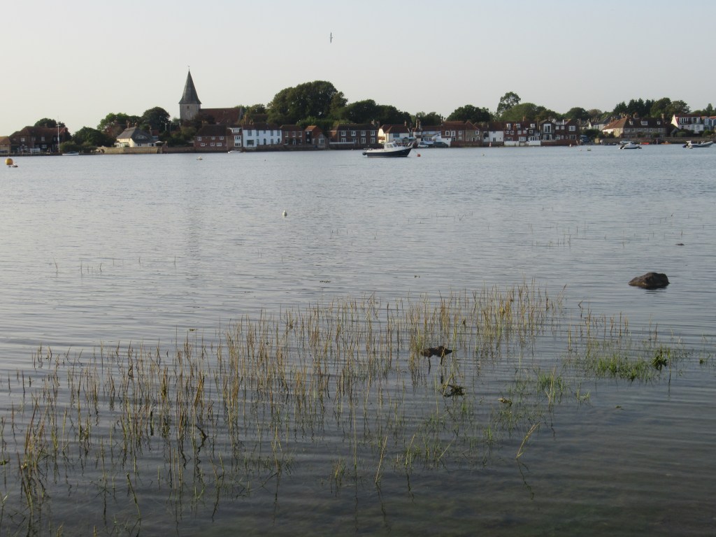
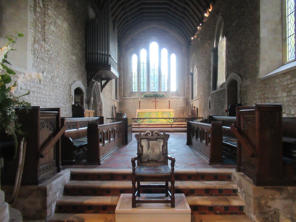
In the village I visit the busy pub and then have a look in the historic Saxon church, which has connections to King Harold, the last Anglo-Saxon king of England, and which appears on the Bayeux Tapestry. It also has an earlier connection to King Canute, which is appropriate given that the village is almost flooded by the tide twice a day.
While here I learn two things about Bosham: 1. I have been pronouncing it incorrectly in my head the whole time, and 2. it is difficult to find the way out. The path along the shore, once I eventually find it, is still blocked by the tide, and I have to find a road out before eventually hitting the shore path again on the edge of the village. From here it is only a short walk to the head of Bosham Channel and then inland to Bosham railway station. From here I catch a train to Chichester and then a bus back to the campsite.
21.0 miles; 33.0 km; 12 hours
Stubcroft Farm Camping, East Wittering (£26)

Leave a comment