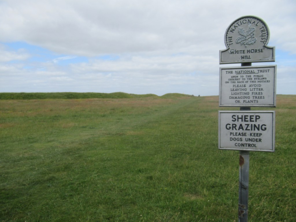
LIDDINGTON HILLFORT TO COURT HILL
2nd July 2023
I got up at 6am to a completely dry tent, thanks to a good breeze blowing up all night from the valley below. The town of Swindon looked a lot better from up here than it did the day before when I got off the train and caught a bus to Avebury. The people I had met there were very friendly though.
After some cereal bars for breakfast, I was packed up and on my way. Dumping my backpack on the trail, I made a short diversion to visit Liddington Hillfort – another Iron Age defensive structure on high ground. There were abundant Skylarks and Corn Buntings singing from all directions, as they were across all of the North Wessex Downs. The Corn Bunting in particular is surprisingly numerous here. Once a common bird of arable farmland, agricultural intensification has led to a crash in its population, and its jangling ‘bunch of keys’ song is becoming harder to hear in my native East Anglia. Apparently they’re all in Wiltshire now, and I think I saw and heard more of them in three days than in the rest of my life in total.
Only an hour and a half into the walk and I had to stop for a long rest in the village of Foxhill. I often find the first couple of days of a hike quite hard going until I’ve got back into shape.
After Foxhill, the route left the road and climbed gently back into proper countryside along a dirt track, passing a pig farm with lots of cute piglets running around. Somewhere near here I had left Wiltshire and entered the county of Oxfordshire.
Further on there was a water tap next to a barn and I stopped for a rest and a bottle refill. The weather was warm and sunny, but a few clouds and a breeze from the west kept it bearable.
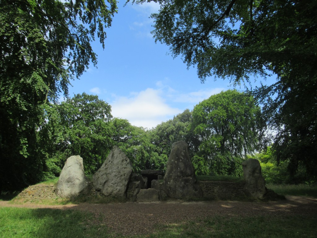
By late morning I had reached Wayland’s Smithy. Despite the name, this is another long burial mound with four standing sarsen stones at the entrance. Built from around 3590 BC, it is as old as the Ridgeway itself, and was used as a burial place for members of the ruling family in this area. Situated amongst trees a few metres off the trail, it made a nice place to sit for a while. There was a man here sitting on a log and playing acoustic guitar and harmonica quietly to himself. I found it incredibly relaxing and it was difficult to pick myself up and move on.

Not far from Wayland’s Smithy the trail climbed steeply to reach Uffington Castle (another Iron Age hillfort) and Uffington White Horse – the original and still the best of the White Horses. Thought to be carved into the hillside around 800 BC, the elegance and beauty of the design are astonishing. I think it looks somewhat like a modern sportswear logo and it makes all the more recent horses look clunky in comparison. Again, the horse needs to be viewed from a distance rather than from right on top of it. The best view I got was actually from the train to Swindon the previous day.
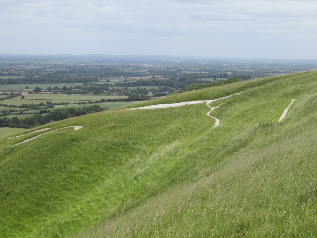
Lower down the hill, below Uffington White Horse, there is a perfect flat-topped hill called Dragon Hill, which legend says is the spot where St George killed the dragon.

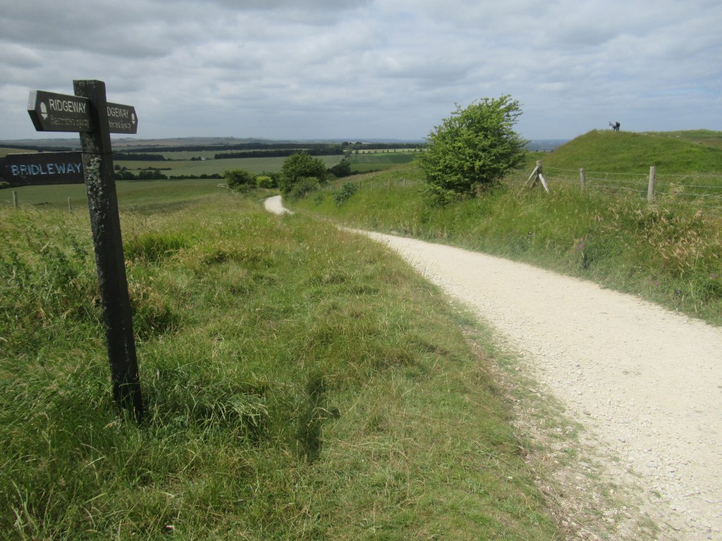
As it was a sunny Sunday afternoon, there were a lot of people on the trail between Wayland’s Smithy and Uffington White Horse – walkers, cyclists and day trippers – but east of Uffington I mostly had the trail to myself again. The Ridgeway, as well as being a hiking trail, is also a bridleway, which means it is open to horses and bikes. Some stretches in the west even allow motorised vehicles. I only saw one motorcycle along the route, but quite a few mountain bikes and a handful of horse riders.
The trail continued mostly downhill with a couple of short uphill climbs. I stopped at another water tap for a refill. These taps are a lifesaver on the western half of the walk as there are practically no amenities on the trail itself. Food and accommodation is available at a series of villages that all lie a mile or two off the Ridgeway so, unless you want to add to your daily millage, you have to make sure you bring enough food and look out for the water taps. Fortunately my guidebook told me where the taps are located.
I passed The Devil’s Punchbowl on my left – a large, steep-sided depression in the landscape – and then the path continued as a wide chalk track gleaming white in the sunshine. Much of the Ridgeway is very wide due to the fact that it was used for centuries by drovers taking their livestock to market.
Near the end of the day I passed Segsbury Camp – the fourth and final Iron Age Hillfort – and eventually I arrived at Court Hill Centre, a hostel and café where I had booked a bed. I got there half an hour before the café closed at 4pm, so I grabbed an early dinner while I still had the chance. There was also a pub about a mile and a quarter (2 km) away, but I didn’t fancy the walk and I couldn’t be sure they were serving food on a Sunday night.
Apparently, the hostel had just played host to a large school group, but that night I was the only guest. The lady who runs it was very friendly and helpful, but she was taking the next day off, so she gave me the keys and I had the whole place to myself. I had a hot shower and hand washed a shirt, then used their very good wifi to catch up on the Tour de France highlights before having an early night. My bed was really comfortable and the empty hostel was completely silent, so I slept blissfully all night.
Court Hill Centre, Court Hill (£19.50)
14.2 miles 22.8 km 8.5 hours

Leave a comment