INTRODUCTION
The Ridgeway is said to be Britain’s oldest road. In use for at least 5000 years, it forms part of an ancient trading route from Wales and the English West Country to East Anglia. These trackways developed naturally as ancient travellers made their way across the drier, higher ground. Initially a series of different interlaced routes across the landscape, the Enclosures Acts of the 18th century divided the open countryside into privately-owned fields and the Ridgeway was squeezed into a single, defined route.
The ancient origins of the trail are evidenced by numerous structures and earthworks that can still be seen today. These date as far back as the Neolithic, Bronze Age, and Iron Age. The Ridgeway was also used by Danish Vikings during their invasion of Saxon England. Moving forward to the modern era, it was designated as one of the fifteen National Trails of England and Wales in 1972.
Keen to tick another National Trail off the list, I chose the Ridgeway because, at 87 miles (140 km), I could walk it in less than a week, and it is relatively close to home.
The route divides neatly into two halves, passing through the North Wessex Downs Area of Outstanding Natural Beauty in the west, and the Chiltern Hills AONB in the east. It passes through five English counties – Wiltshire, Oxfordshire, Berkshire, Hertfordshire and Buckinghamshire. The first day was spent entirely in Wiltshire, but I was never sure exactly when I crossed from one county to another.
AVEBURY TO LIDDINGTON HILLFORT
1st July 2023
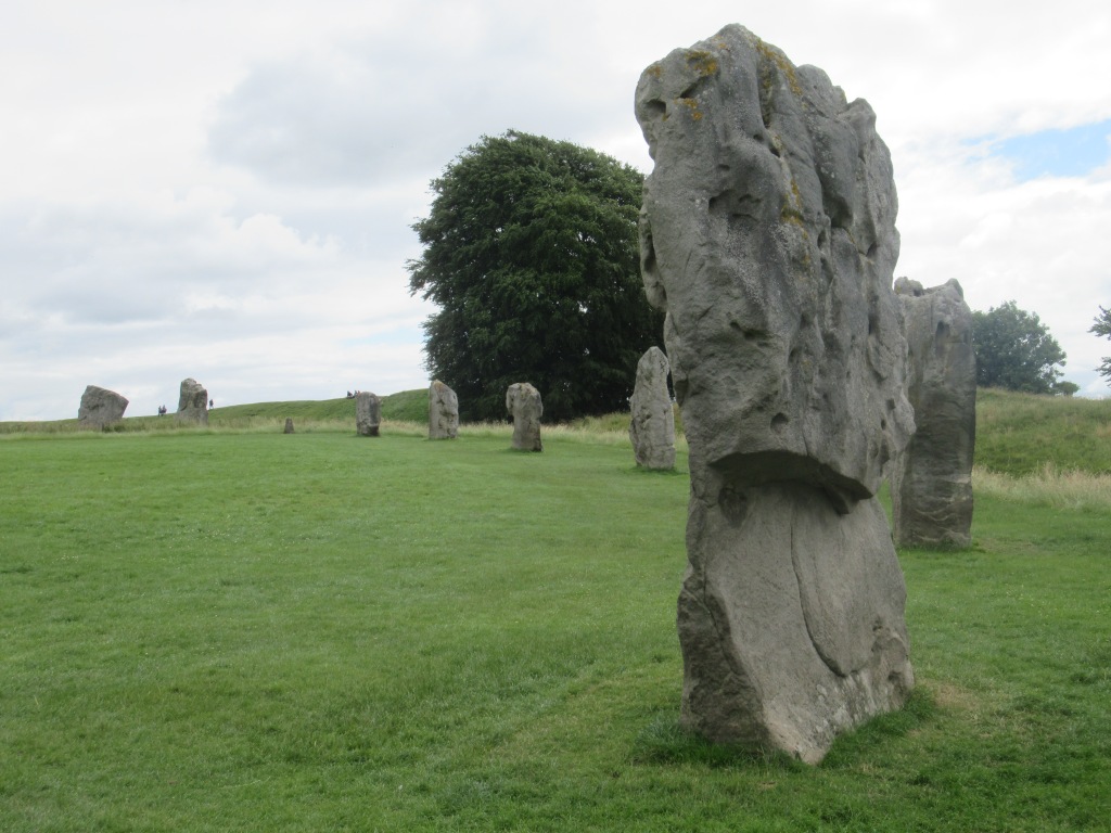
The Ridgeway doesn’t start in Avebury, but I don’t understand why not. The official start is 1.7 miles (2.7 km) away at Overton Hill, but Avebury is a much more impressive place to begin and it would be a shame to miss it. For a start, this attractive village sits partially inside a huge Neolithic stone circle – one of the largest in the world and surrounded by an earth bank and ditch. This is thought to have taken 500 years to construct, starting around 2500 BC. While I was there a large group of bikers rode through the village on vintage motorcycles – mostly Royal Enfields.
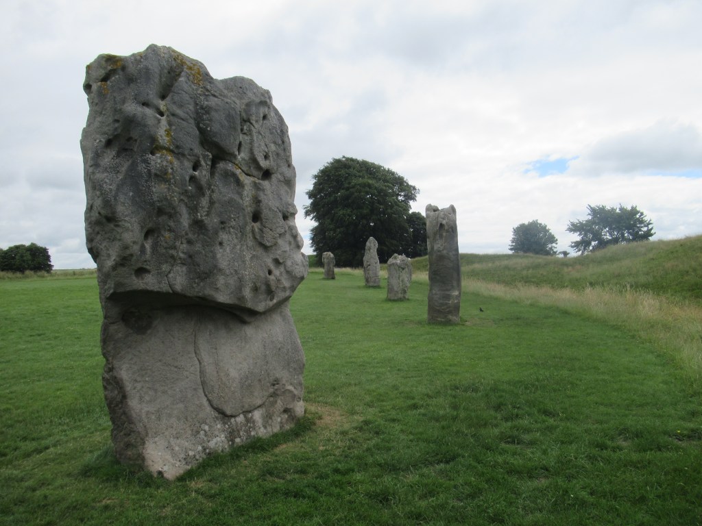
The stone circle is just one of the ancient monuments in the area. From the village I walked south-east along West Kennet Avenue, which consists of two rows of standing stones leading away from the stone circle, built around 2400 BC. Dark clouds were blowing over and I got caught in a brief rain shower immediately after setting off.

The next ancient monument to come into view was the mysterious Silbury Hill – a symmetrical man-made hill began in 2600 BC, the purpose of which nobody really knows. Not far beyond is West Kennet Long Barrow, requiring a short diversion off the route. This is a burial mound 100m (328 feet) long, and dating back to 3600 BC, in which archaeologists have found the remains of 45 men, women and children. Some of the inner chambers can still be entered. I heard a Quail calling from deep within the crops near here. Scarce enough to hear one in the UK, but almost impossible to see. From memory, I’ve heard four and seen only one in 50+ years.


The last place to visit before the start of the Ridgeway is the Sanctuary, again dating back to 2500 BC. There is not much left to see now, but this was the site of a stone and wood structure thought to have a ceremonial purpose. The positions of the stones and wooden posts are now shown by concrete markers. By the time I got there the sun had come out and revealed a wide panoramic view of the surrounding countryside. That was to be the first of many impressive views along the trail.
Just across the road from the Sanctuary is Overton Hill, the start of the Ridgeway, with some more, smaller burial mounds nearby. Before starting I chatted to three young hikers who had just finished the walk in the opposite direction. I didn’t realise it at the time, but they were to be the only Ridgeway through-hikers I would meet.
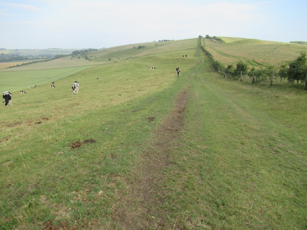
It was early afternoon by the time I set off, initially heading due north up a gentle incline with the sun behind me. The landscape consisted of open, rolling grassland and crops, with views stretching out into the distance as I gained height. This was to be the standard for the next three days on the North Wessex Downs. This is very open, often treeless country and the path was usually obvious up ahead. When viewed on a map, the trail can be seen to meander north and south, especially on the first day, but in practice I always felt like I was heading east along a fairly straight bearing. These long, apparently straight sections, with few buildings in view, made it easy to imagine being an ancient traveller on the Ridgeway.

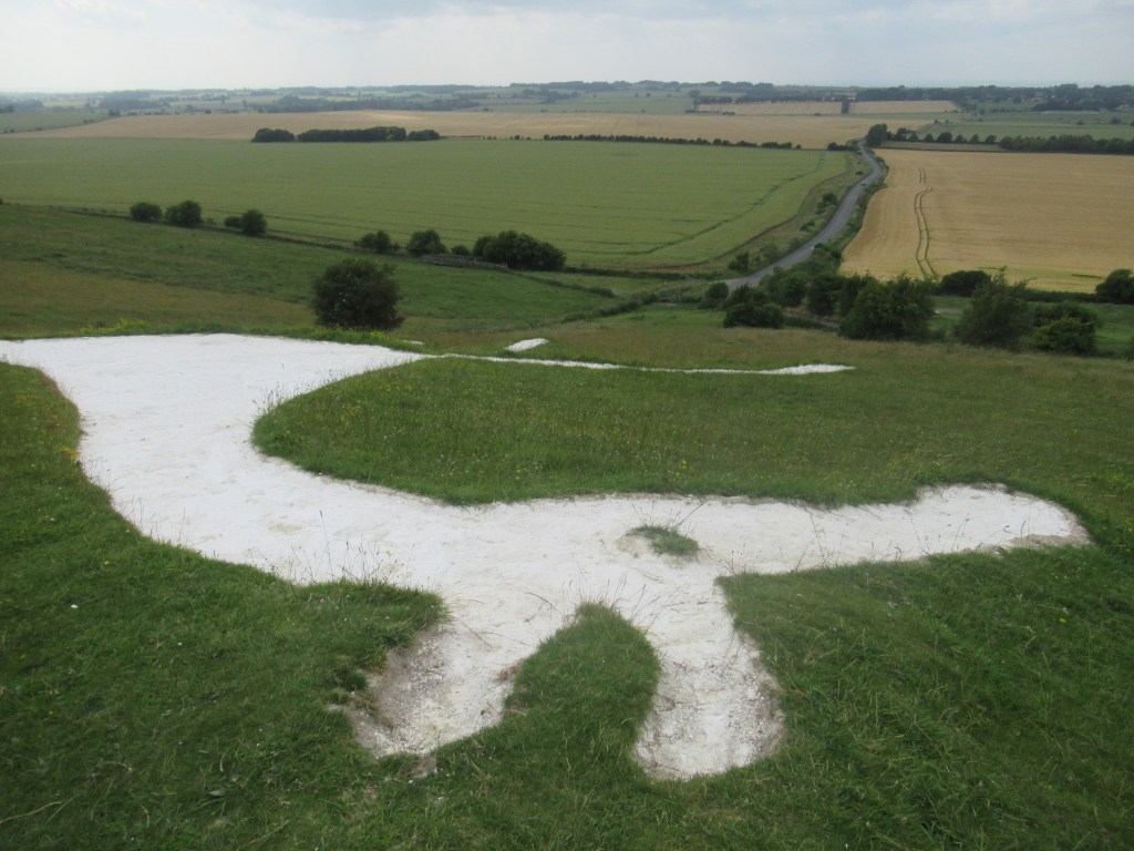
A couple of hours after starting I made a short detour off the trail to visit Hackpen White Horse. There are many white horses carved into the chalk hillsides around Wiltshire. In fact, there is a White Horse Trail – a circular hiking trail of 93 miles (150 km) that links a few of them. The one at Hackpen is a relative youngster, made in 1838, and is quite small. Of course, it’s impossible to get a good view from ground level, especially when you’re standing right next to it. Later I had a look at pictures and it’s quite badly drawn, with long, spindly legs and a tiny head.
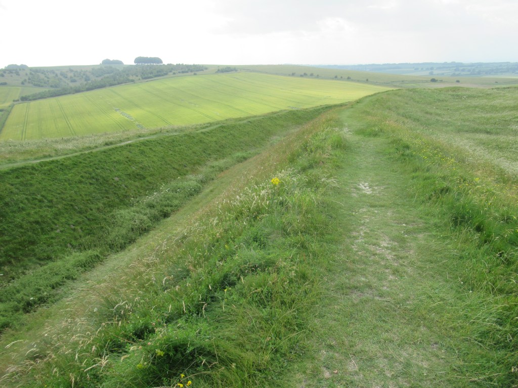
Further on, the trail went right through the centre of Barbury Castle. Rather than the popular image of a Medieval castle, this is the first of four Iron Age hillforts on the Ridgeway (so, built between 800 BC and 43 AD – before the Roman occupation). What remains now are some deep ditch and rampart earthworks in a rough oval. The raised location of the fort is impressive even now, and it continued to be strategically significant after the Romans left and the Saxons arrived. Even as recently as World War II it was equipped as a defensive position in case of invasion.
A few Red Kites were flying around up there – not the first ones I saw that day, but they would become constant companions throughout the Ridgeway walk.
There were some public toilets at the carpark near the fort, but they were locked up and looked like they had been closed for a while.
The next leg took me across Smeathe’s Ridge, my favourite part of the day, with a wide, soft, grassy path, great views on both sides, and the wind behind me. I stopped for a dinner of sandwiches and backpack snacks, then descended into the chocolate box hamlet of Hallam, where most of the cottages were thatched. One of them had a drinking water tap available for hikers, which was welcome after the locked toilets and no other water sources all day.
The last two hours of the day felt like hard work – uphill out of Hallam, through some wooded areas on hard, stony tracks, and a bit of road walking. Eventually I passed a flat, grassy area amongst trees about a mile south of Liddington Castle. It had a wooden bench and a nice view, and it looked ideal for a wild camp, but I wanted to walk a bit further. About half a mile (1 km) beyond I realised I wouldn’t find a better place, so I walked back and set up my tent at 9pm. I slept fairly well, if a little uncomfortably. I was woken up once by a hooting Tawny Owl and once, bizarrely, by car headlights lighting up my tent. I looked outside and saw the rear lights moving off through the trees. Looking around next morning, I still had no idea how a car got to that spot.
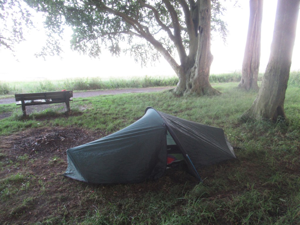
Wild camp near Liddington Castle (free)
15.7 miles 25.3 km 9 hours

Leave a comment