29th April 2023
STOWMARKET TO IPSWICH
The sun is shining and it’s a perfect spring day for another local walk. This time it’s a one-day meander through beautiful countryside in the county of Suffolk. ‘Meander’ is exactly the right word for it as well, as this walk follows the twisting course of the River Gipping between the towns of Stowmarket and Ipswich. The river flows slowly across this flat landscape and the walk should be taken slowly as well, as it passes for 17 miles (27km) through floodplain meadows, along riverbanks well wooded with willow and alder, past paddocks of sheep, cows and horses, and numerous fishing lakes formed by gravel extraction. Occasional trains pass by as this route often runs close to the railway line between Cambridge and Ipswich, sometimes passing under the line itself.
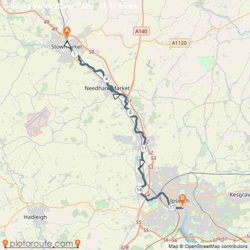
Suffolk is unquestionably England’s finest county. I am completely unbiased in this view, and the fact that I was born there is neither here nor there. I’ve walked most of this route a couple of times before, but I’ve always started from Ipswich and, after walking about 12 miles (19 km), I’ve always bailed at Needham Market, where the path passes close to the railway station. Today I’ve outsmarted myself and started in Stowmarket, so I’ll have no option but to continue to the end.
From Stowmarket station I walk a little way beyond the start of the path to where the river flows under Crown Street. The River Gipping actually rises a few miles north-east of Stowmarket, but this stretch doesn’t have a footpath, so the trail starts in town. The walk is almost entirely on the old tow path along the river and, on this early stretch, it passes some light industrial areas on the outskirts of town. These include a former explosives factory once owned by Alfred Nobel, now manufacturing paint as evidenced by the smell and by some riverside seats in the shape of different coloured paint tins. A Kingfisher zips past above the water.
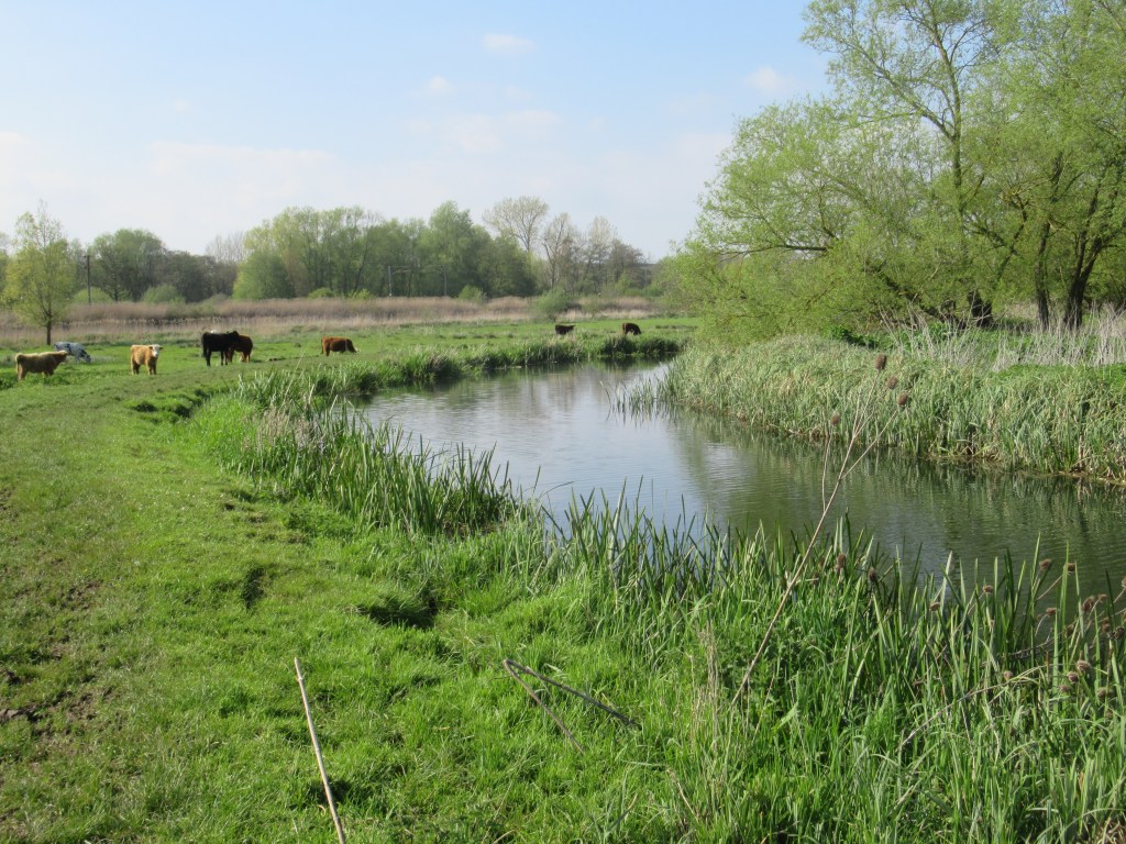
Eventually I pass under the railway for the first time and the scene suddenly changes to a rural idyll. The sound of traffic fades away to be replaced by spring birdsong, and some deer are grazing in the meadows – Muntjac and Roe Deer.

At a small wooden footbridge over a stream, a council sign says the footpath is closed due to a damaged bridge. The bridge is fine, if a bit decayed, so I cross it anyway. The barriers placed at either end have been pushed aside, so I’m clearly not the only person ignoring the instructions to “find an alternative route”.
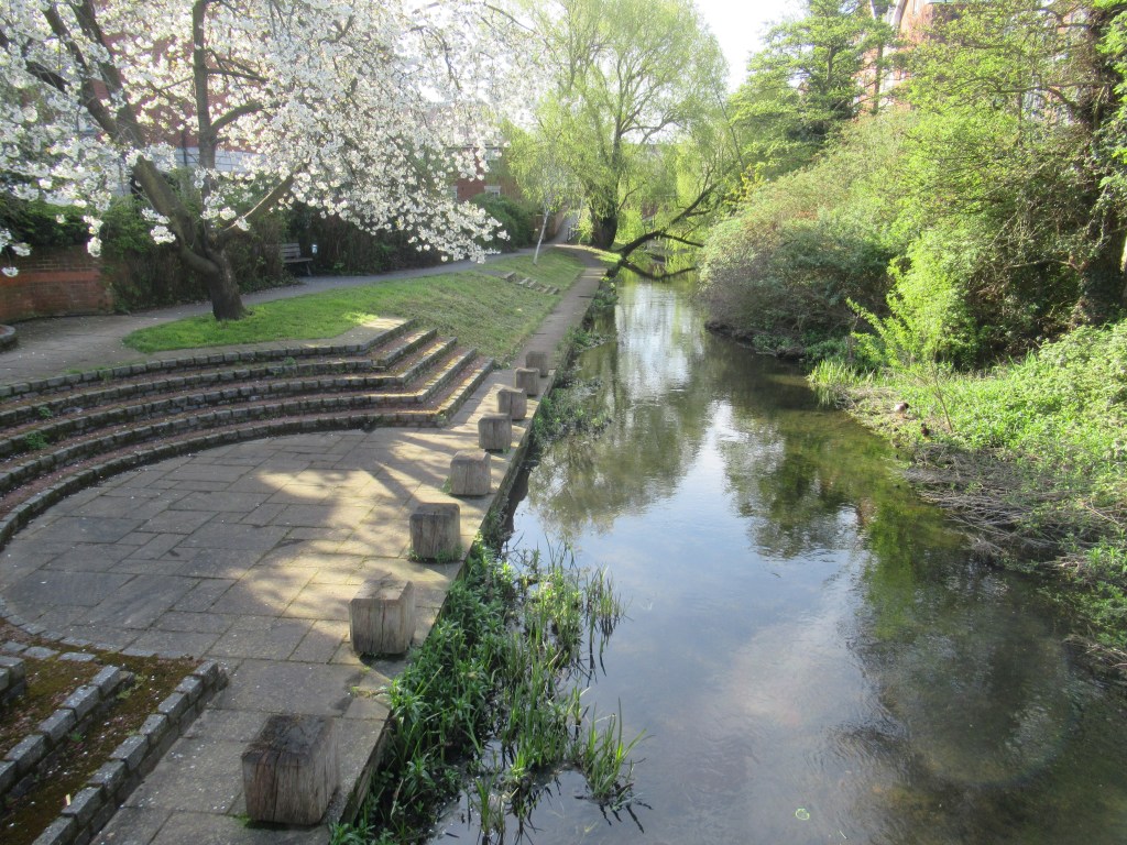
About 4.5 miles (7 km) in, I reach the town of Needham Market. The path continues along the river, but I cross a bridge and skirt around Needham Lake Nature Reserve. There are toilets and a café here, as well as Needham Market railway station – today filled with Ipswich Town FC fans heading to the match. The railway arrived here in 1846 but the station was closed in 1967 as part of the Beeching cuts. In an unusual move for the railways, it was reopened in 1971.
A very low ‘cattle tunnel’ passes under the line to reach the town centre, which has an attractive High Street and all the amenities you would expect. It has now gone midday, so I decide to stop for a drink. There are two pubs within easy reach of the trail, on opposite sides of the High Street. Not wanting to show favouritism, I sample them both – strictly for research purposes of course – and I can report that both of them serve beer.
Back on the path, I continue through an area of fishing lakes with many aggressive signs warning me not to stray from the path and onto the lakesides, and telling me of their CCTV cameras. Presumably these security measures are aimed at poachers rather than hikers, which is fair enough.
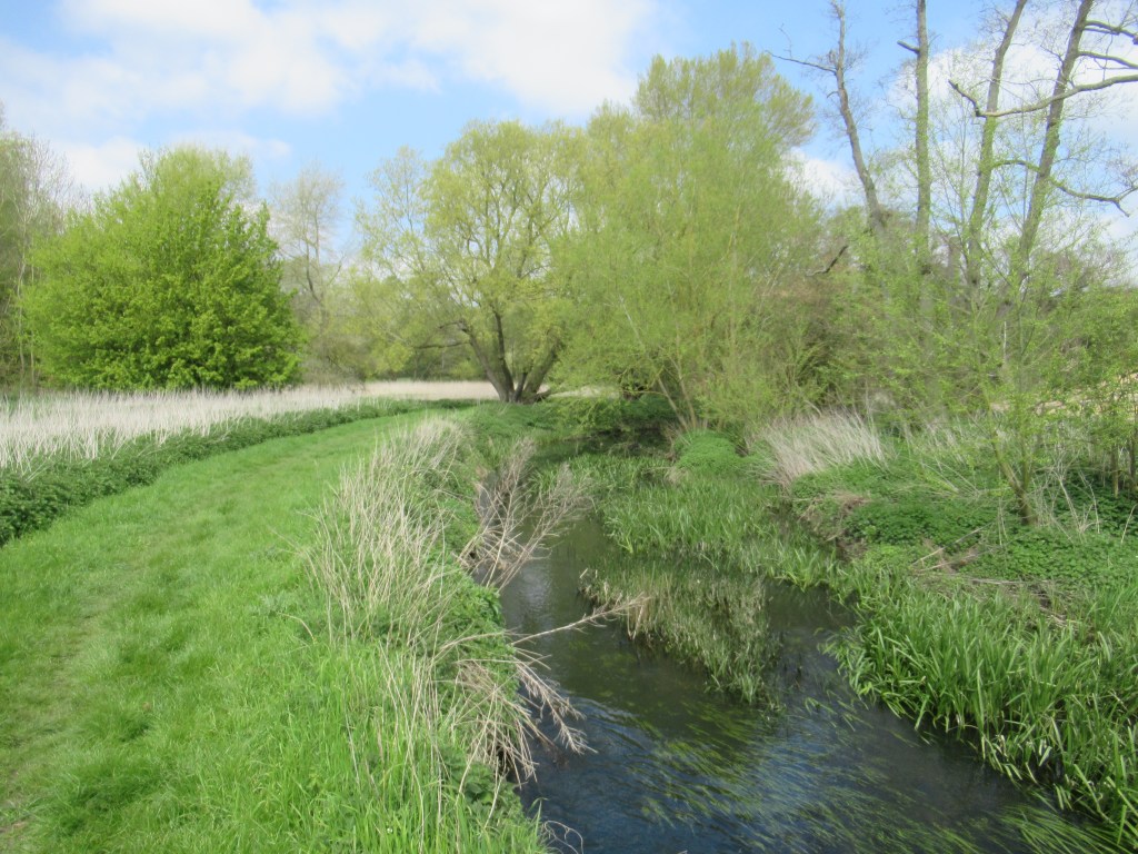
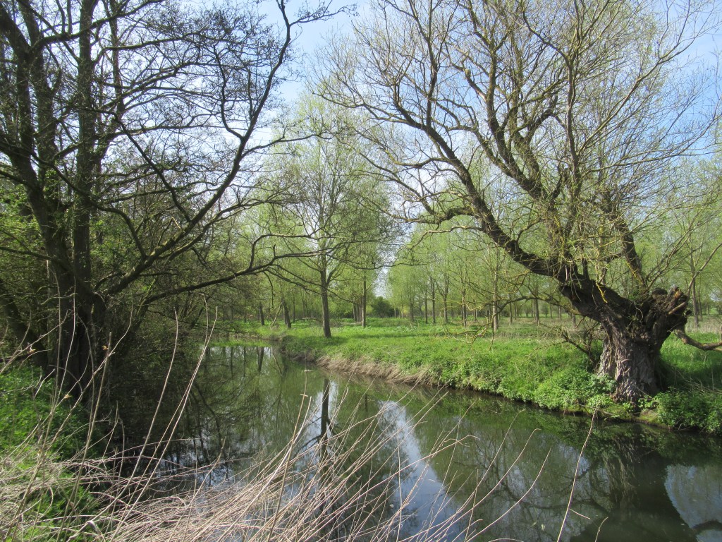
Between Needham Market and Ipswich, the path crosses back and forth over the river numerous times. For the whole of the route the river is rarely more than about 10m (33 feet) wide, and usually nearer 6m (20 feet). While nowadays it is an attractive stream filled with water plants and passing through some well wooded areas, in the past it was an important navigation for the transport of freight. It was navigable at least as far back as 860AD, and between 1065 and 1095 it was used to transport Caen stone from Normandy for the construction of the abbey at Bury St Edmunds.
Full navigation was opened in 1793. Explosives, grain and hops were all transported, but the main cargo was manure – making me think that this could possibly be the original proverbial creek up which one often finds oneself without a paddle.
When the railway arrived, trade on the river declined, until only a few boats were left by 1900 and the river fell into neglect by the 1930s. Restoration work started in 1970, and the tow path was cleared to form the Gipping Valley River Path. The river contained at least 15 locks, the remains of which can still be seen as small, man-made waterfalls between brick walls.

Further along, I come to another ‘Footpath Closed – Unsafe Bridge’ sign. This time the barriers are sturdy wood and metal structures that look more permanent, and probably involved as much effort and expense as replacing the bridge would have done. They are easy enough to climb around and the bridge is indeed a bit dilapidated, but still passable.
I stop near Pipp’s Ford for a snack and a brief rest before continuing to Baylham Lock, where a third footpath closure sign awaits – this time due to a ‘collapsed bank’ that has already been fixed. Beyond here there is a rare breeds farm on the other side of the river, with various different sheep and cattle, and then some more fishing lakes.

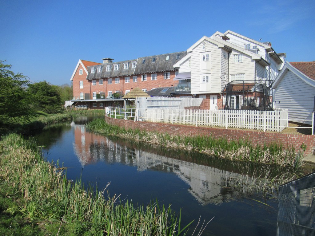
At Rushbrook Mill the old mill building has been converted into some very nice flats. There are quite a few of these defunct water mills along the route – attractive buildings now converted into homes and business premises. I hear a Nightingale singing from an unseen perch across the river – newly arrived from its wintering grounds in Africa and my first one of the year. They have declined greatly in the UK, but Suffolk is still one of the best counties in which to find them.
The path continues through the very attractive area of Bramford Meadows Local Nature Reserve and then past some more water meadows as I start to approach Ipswich. Passing under two railway lines in quick succession, the way is now paved and gradually becomes more urbanised. Closer to town I pass many fans of the mighty Ipswich Town FC returning from the match. My team have just won 6-0 in the penultimate game of the season and secured promotion to the Championship. Everyone is understandably in a good mood.
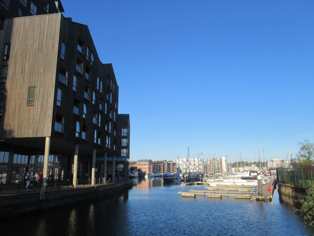
The river is now much wider and becomes tidal as it flows towards the estuary. At some point here it stops being the River Gipping and becomes the River Orwell for reasons best known to itself. I reach the end of the walk at Stoke Bridge, with its heavy road traffic, but continue a short way to the docks on the other side. In the mid 80s I did a college course here and used to walk through the docks. At that time they were a bit rough and dilapidated, with only a couple of facilities still operating. Since then they have been regenerated, with flats, bars and restaurants, and are now filled with various leisure craft. It is early evening on a Saturday and the area is lively with people enjoying the sunshine. In a happy frame of mind, I head to the station to catch the train back along the route I have just walked.
17 miles 27km 9.5 hours
This was an easy walk – flat and on well-maintained paths with no road walking involved, although the tow path is paved in Ipswich. There are virtually no waymarks other than ‘Public Footpath’ signs, but it is very easy to navigate as it clings stubbornly to the river. It is covered by OS Landranger maps number 155 and 169, and there are railway stations and car parks at both ends. The only refreshments and toilets on the route are in Needham Market, but the path passes close to some villages within easy walking distance.

Leave a comment